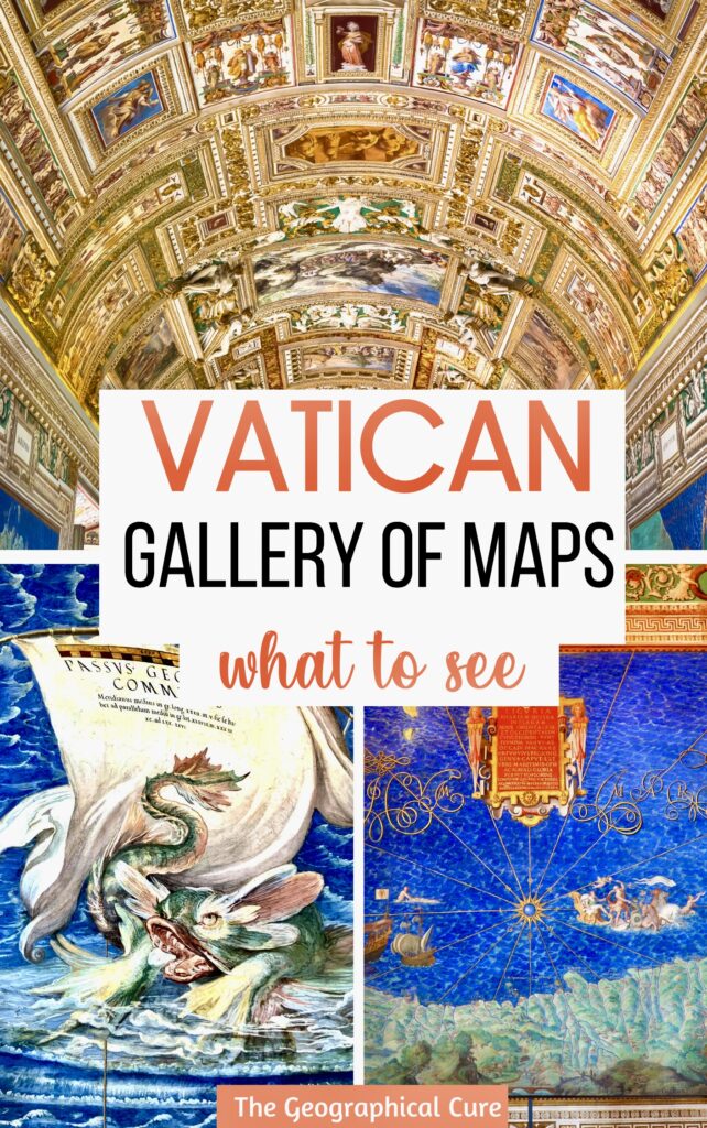
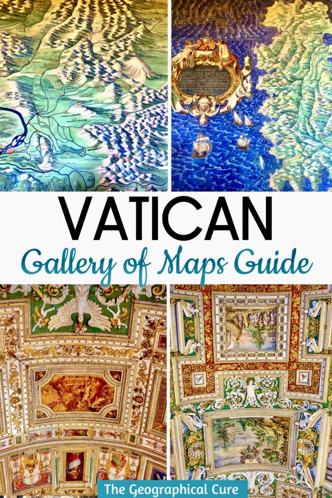
The Gallery of the Maps is one of the most spectacular spaces in the Vatican Museums. It’s beautiful, colorful, and a remarkable achievement of art and science.
The gallery is a long extended corridor about 400 feet long, over a football field in length. It houses the largest cycle of geographical pictures every painted.
Overview & Mini History
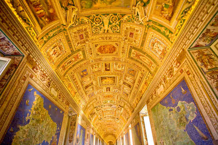
The gallery walls are entirely covered with maps. That’s, of course, where the space takes its name.
There are 40 frescos on the walls. They detail the Italian regions and papal properties that existed during the papacy of Gregory XIII around 1580. There’s also quite a bit of stucco and gilded relief.
The cartographer who drew up the maps was Fra Ignazio Dante from Florence. He entered into the Dominican order later in his life, earning this name.
Dante was an astronomer, cartographer, and mathematician — essentially a science polyglot. He was the man responsible for drawing up maps in the Palazzo Vecchio.
Gregory XIII invited him to Rome. And he was ultimately commissioned to draw the maps you see today.
The gallery was intended to showcase the power of the church and its deep connection to the Italian territories. It was also a display of the scientific and cultural advancements of the Renaissance.
The way you experience the Gallery of the Maps, you are entering at the opposite end intended.
Originally, visitors started from the door closest to the Sistine Chapel, seeing the maps from north to south. Today’s visitors experience the gallery in reverse, moving from south to north. This change in the route was designed to manage the museum’s visitor flow.
Gallery of Maps: What To See
When you walk in, if crowds permit, take a look at the glass doors.
These doors carry the names of the contemporary patrons of the Vatican Museums, who were responsible for financing the restoration of the Gallery of Maps in 2012.
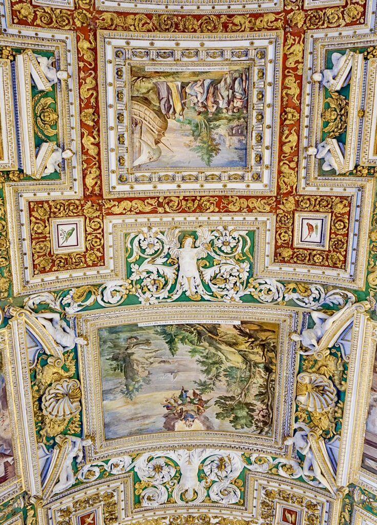
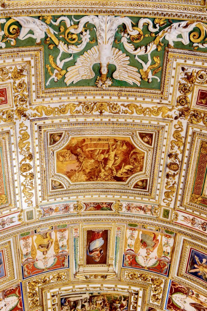
Ceiling
The ceiling decoration is what will capture your attention first. It’s a typical Baroque ceiling, executed by an artist named Cesare Nebbia. He was an Italian painter from the Mannerist period, working in the 1580s.
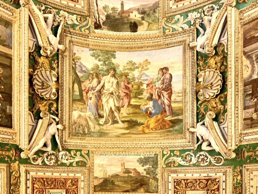
In Rome, these types of ceiling were relatively common. But not to this degree. When you extend the concept to this length, it becomes quite breathtaking.
There are 17 main pictures, alternating smaller images with large square images in stucco frames.
The ceiling’s theme is the papal claim to secular and spiritual supremacy. There are allegorical, religious, and mythological scenes.
You’ll see images from the history of Rome and the papacy, including the baptism of Emperor Constantine, the Battle of the Milvian Bridge, and scenes from mythology and the Old Testament (like the sacrifice of Issac).
Maps
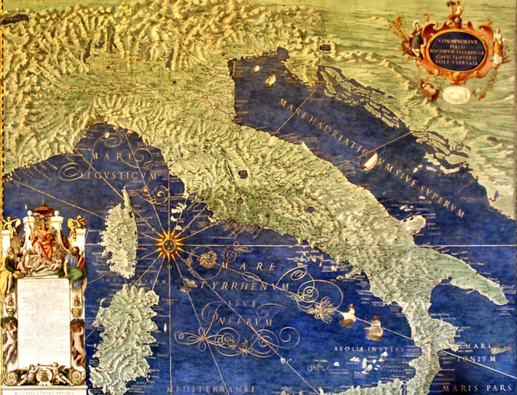
After that, what you’ll see first is maps juxtaposing Italia antica and Italia novo. They depict ancient Italy and Italy as it was in the 16th century. At the top right is an allegory of Italy as a young woman.
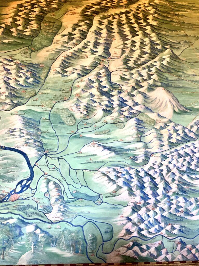
These maps are followed by the Italian provinces, the major islands, and the area of the papal seat in Avignon.
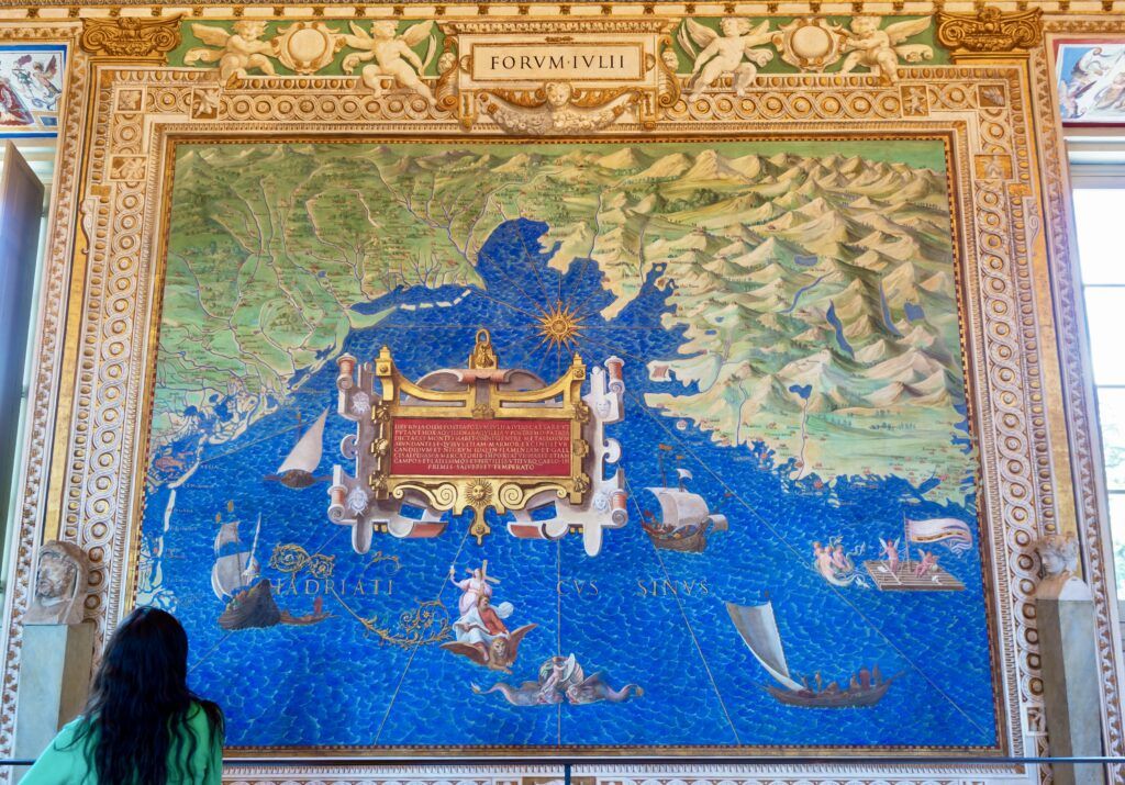
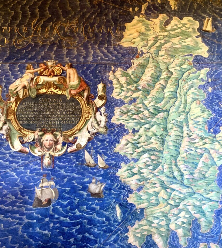
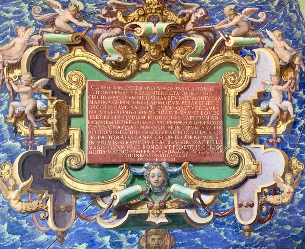
Each map is set in a broad rectangular frame with various ornamentation. Cartouches on top identify each location.
They are painted in an illusionist manner. Some maps have smaller inserts with city views that are set into them, complete with frayed edges and curling corners to make them look authentic.
The maps depict every place of significance in the history of Italy and the Papal States. You’ll see a breakdown of Italy’s various geographical regions, principalities, city states, etc.
The Gallery of Maps is arranged in a way that effectively divides Italy into geographical halves, east and west.
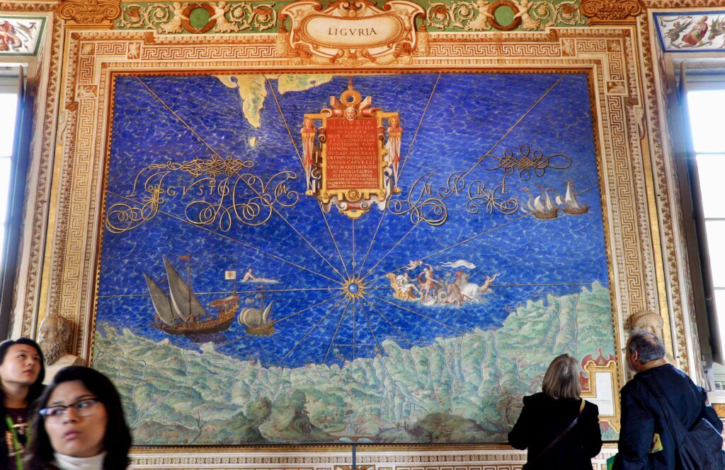
One side of the gallery depicts regions surrounded by the Ligurian and Tyrrhenian seas, on the western side of the country — Liguria, Tuscany, Lazio, Campania, Sicily, Sardinia, etc.
The other side depicts regions surrounded by the Adriatic Sea on the eastern side of the peninsula — Veneto, Emilia-Romagna, Le Marche, Abruzzo, Puglia, etc.
The sequence of the maps follows a north-to-south progression, offering viewers a comprehensive cartographic tour of Italy. They also incorporate historical and ancient sites.
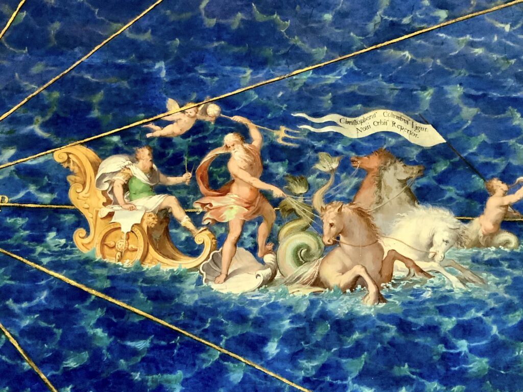
To top that off, the maps are rich in color and detail. To add to their vivacity, they’re decorated with white capped waves, sailing ships, the sea god Neptune, and fantastical sea creatures.
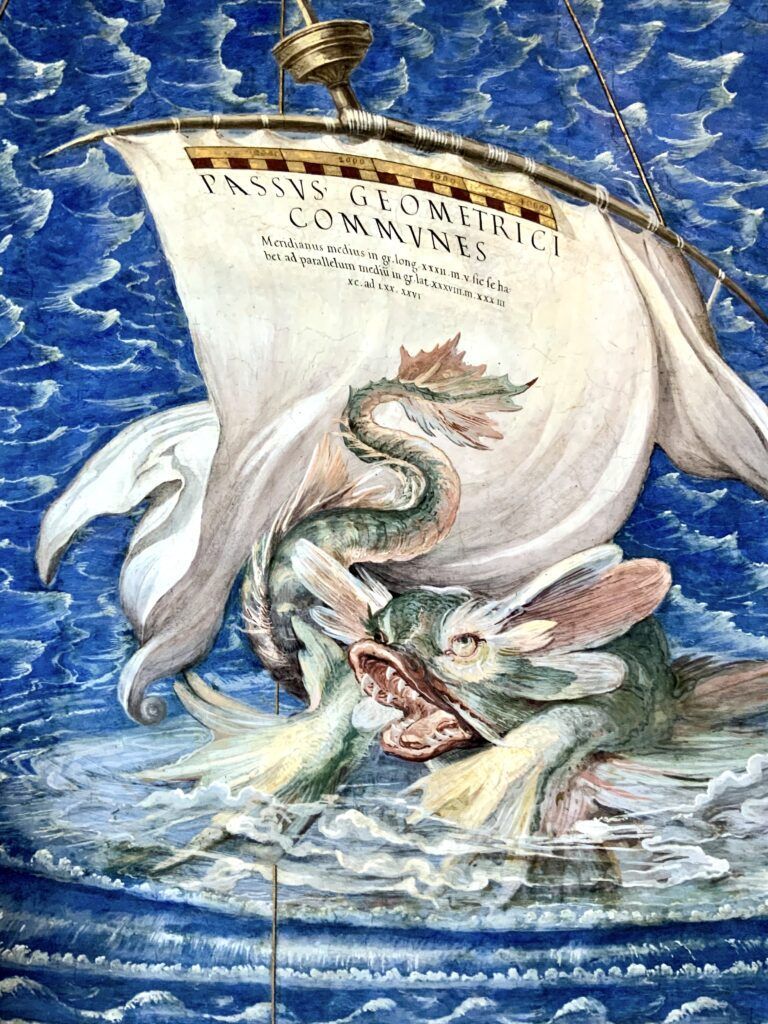
The maps on the wall are considered about 80% accurate in their geography and topography. What the artists didn’t know, they simply left out.
The maps are drawn from a bird’s eye view perspective, which assumes you are looking down on them from Rome, the center of the universe,
So, you’d be looking down at places like Calabria, Puglia, and Sicily. The images of these regions look inverted, and in fact they’re upside down.
Sicily, for example, is depicted as a mountainous island set in a dark blue sea with waves breaking against the shoreline. Individual cites are superimposed on the sea, the largest being Syracuse.
An aerial view of Venice occupies a narrow space on the southern end of the wall. It’s shown from above, with the long loops of the Grand Canal clearly visible. At the center is St. Mark’s Basilica.
You can see Sardinia, Corsica, and Etruria (a mountainous region comprising Tuscany and parts of Umbria).
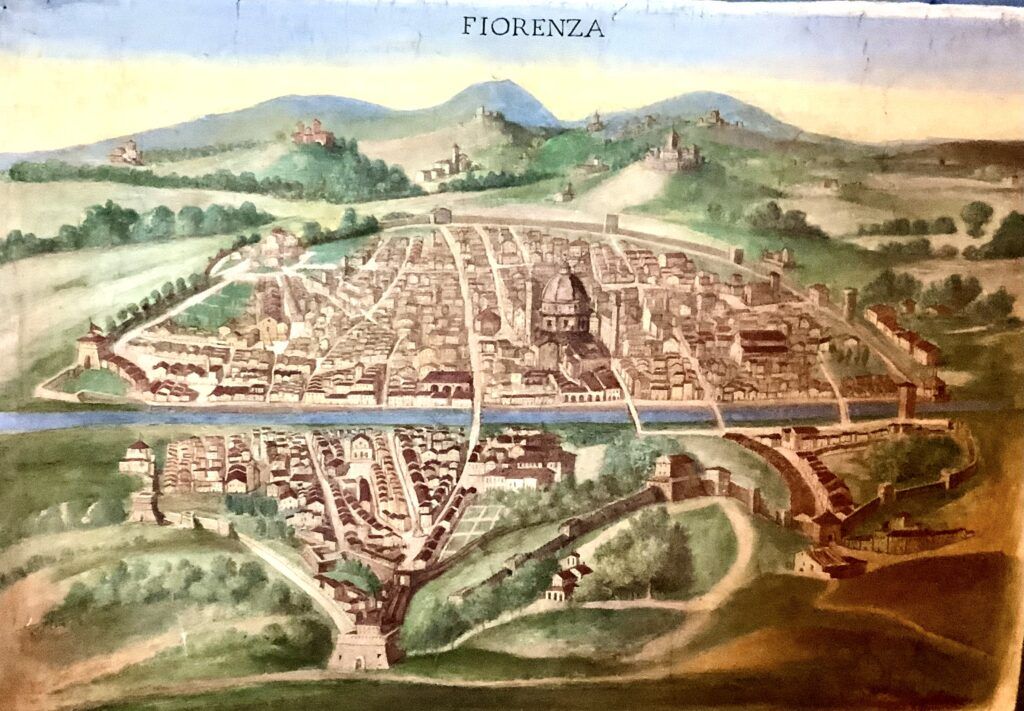
If you are interested in Tuscany (me!), if you look off center, you can see the city of Florence identified as Fiorenze.
Then, there’s Pisa and its rival city of Lucca. If you follow the Arno River all the way back to Florence you’ll find the other great city state — Siena.
You can also see some archaeological sites, which the painters depicted as ruins.
The extent of detailing is impressive. When you’re scrutinizing the maps, you’ll see some golden crosses. This indicates towns that have cathedrals.
One map often highlighted for its significance and impressive detail is the map of the Ancient Latium. This area holds profound historical and cultural importance as the heartland of the Roman Empire.
The map captures not only the geography but also the rich history of the area, including ancient Roman roads, towns, and landmarks that have shaped the history of Italy and Western civilization.
READ: History of Ancient Rome
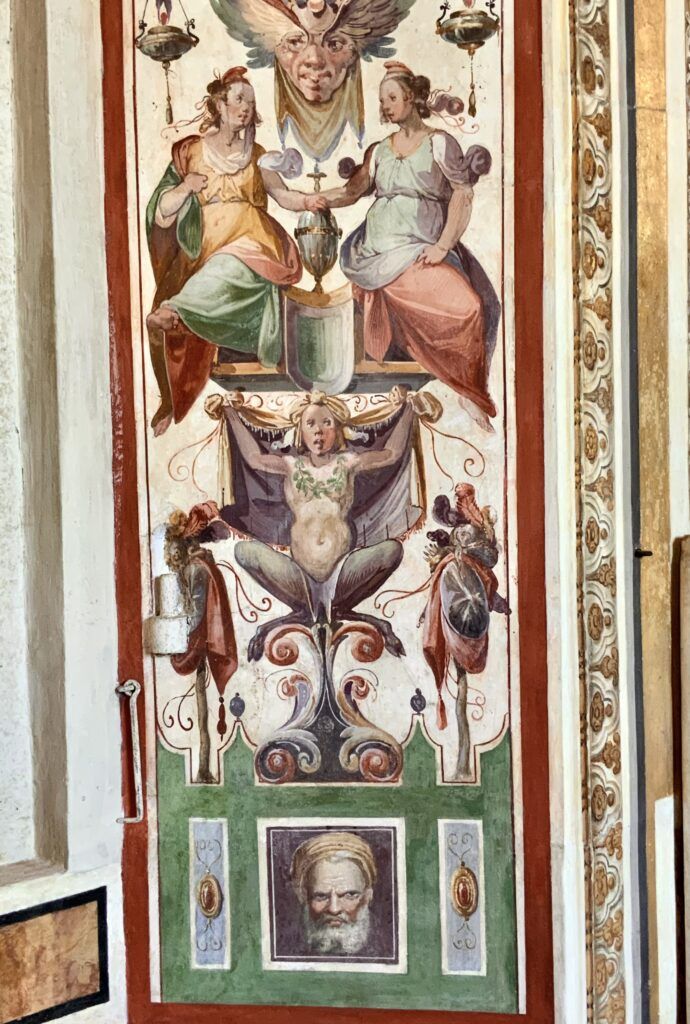
As you walk along the gallery, you’ll see frescos featuring vines, demon-like heads, and peculiar children between the window sills. This style, known as grotesque, was a popular decorative motif in Renaissance.
Early in the 16th century, artists including Raphael were inspired by ancient Roman frescoes found in Nero’s Golden House. This led to the widespread adoption of this whimsical style.
Once you reach the exit, they’re a couple things to notice. The last maps are depictions of the four major Italian ports of 16th century Italy — Venice, Ancona, Genova, and Civitavecchia.
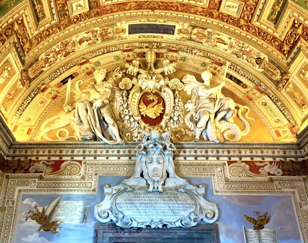
You may also notice the two papal coats of arms that surmount the door. The lower is the most recognizable — a shield with bumblebees. This is the coat of arms of the Barberini pope, Pope Urban VIII.
The other coat of arms has a golden dragon on a red field. That is the coat of arms of Gregory XIII.
Fun Fact: Pope Gregory XIII is that he is best known for commissioning the Gregorian calendar, the calendar system most widely used in the world today. Before the Gregorian calendar, the Julian calendar was in use, which had been established by Julius Caesar in 46 B.C.
Practical Information for the Gallery of Maps
Address: 00120 Vatican City
Hours: Monday through Thursday 8:30 am to 6:30 pm. Friday and Saturday from 8:30 am to 10:30 pm. Closed Sunday.
Tickets: Click here to book a timed entry skip the line ticket for the Vatican Museums. To avoid crowds, you can also book an early morning ticket or a nighttime tour.
I hope you’ve enjoyed my guide to the Gallery of Maps. You may find these other Vatican guides useful:
- Masterpieces of the Vatican
- Guide to the Vatican Pinacoteca
- Guide to the Vatican’s Raphael Rooms
- Guide to the Sistine Chapel
- Underpants in the Sistine Chapel
- Guide to St. Peter’s Basilica
- 1 day itinerary for Vatican City
- Hidden gems in the Vatican
- Famous sculptures in the Vatican
Pin it for later.